LOF_31_hoven
- Distance: 3.8 Km
- Elevation gain: 356 m
- Maximum elevation: 310 m
- Elevation loss: 356 m
- Minimum elevation: 7 m
Interactive map
GPS track profile
About this GPS track
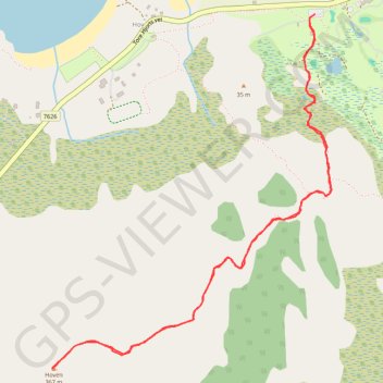
Name: LOF_31_hoven GPS track, route, trail
Start: Tore Hjorts vei, Hov, Vågan, Nordland, 8314, Norvège (68.34002 14.12478)
End: Tore Hjorts vei, Hov, Vågan, Nordland, 8314, Norvège (68.34002 14.12478)
Coordinates: 68.33052 14.10568 68.34002 14.12596
Other GPS tracks
Click on a GPS track to view route, its statistics and profile.
Stage 1: Arctic Ocean to Väylä — European Divide Trail
Distance: 2,785.0 Km • Elevation gain: 23,823 m • Maximum elevation: 722 m