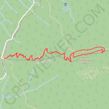
Mount Timbertop
- Distance: 6.0 Km
- Elevation gain: 436 m
- Maximum elevation: 1,267 m
- Elevation loss: 436 m
- Minimum elevation: 861 m
- Moving time: 1 h 47 m
- Moving speed: 3.3 Km/h
- Maximum speed: 6.5 Km/h
- Total time: 1 h 57 m
- Global speed: 3.1 Km/h
- Date: 22/04/24
Interactive map
GPS track profile
About this GPS track
Name: Mount Timbertop GPS track, route, trail
Start: Old Howqua Track, Howqua Hills, Shire of Mansfield, Victoria, 3723, Australia (-37.15380 146.30427)
End: Old Howqua Track, Howqua Hills, Shire of Mansfield, Victoria, 3723, Australia (-37.15377 146.30419)
Coordinates: -37.15428 146.30416 -37.15215 146.32240