Har Turan
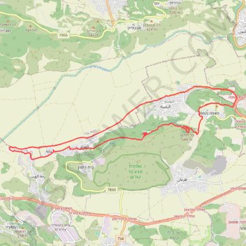
Interactive map
GPS track profile
About this GPS track
Name: Har Turan GPS track, route, trail
Start: Al Batuf Regional Council, Jezreel Subdistrict, North District, 1710801, Israel (32.78771 35.31283)
End: Al Batuf Regional Council, Jezreel Subdistrict, North District, Israel (32.78783 35.31306)
Coordinates: 32.78486 35.29242 32.81334 35.39794
Topography: Al Batuf Regional Council topographic map, elevation, terrain
Other GPS tracks
Click on a GPS track to view its route, statistics and profile.