Woodland Fort paths
- Distance: 5.3 Km
- Elevation gain: 97 m
- Maximum elevation: 82 m
- Elevation loss: 47 m
- Minimum elevation: 11 m
- Moving time: 58 m 58 s
- Moving speed: 5.3 Km/h
- Maximum speed: 46.9 Km/h
- Total time: 1 h 11 m
- Global speed: 4.4 Km/h
- Date: 14/04/24
Interactive map
GPS track profile
About this GPS track
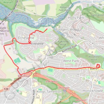
Name: Woodland Fort paths GPS track, route, trail
Coordinates: 50.41147 -4.18761 50.42186 -4.15349
Other GPS tracks
Click on a GPS track to view route, its statistics and profile.
Tour de la petite Manche Angleterre
Royaume-Uni > Angleterre > Plymouth
Vélo. En aller simple entre Plymouth et Weymouth. #Vélo
Distance: 273.9 Km • Elevation gain: 4,094 m • Maximum elevation: 297 m
TT22 Jo11 J9/06 : Cheddar à Plymouth Ferry Terminal
Royaume-Uni > Angleterre > Somerset > Cheddar
Distance: 268.2 Km • Elevation gain: 4,170 m • Maximum elevation: 458 m