Home78Rec
- Distance: 78.4 Km
- Elevation gain: 1,479 m
- Maximum elevation: 461 m
- Elevation loss: 1,479 m
- Minimum elevation: 4 m
Interactive map
GPS track profile
About this GPS track
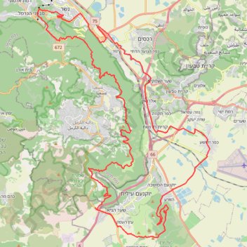
Name: Home78Rec GPS track, route, trail
Start: Ramot Yitzhak, Nesher, Haifa Subdistrict, Haifa District, Israel (32.76669 35.03652)
End: Ramot Yitzhak, Nesher, Haifa Subdistrict, Haifa District, Israel (32.76670 35.03642)
Coordinates: 32.61829 35.01634 32.77054 35.15277
Other GPS tracks
Click on a GPS track to view route, its statistics and profile.
סיבוב בעמק יזרעאל
Israel > North District > Emek Izrael Regional Council > Beit Zaid
Distance: 45.8 Km • Elevation gain: 414 m • Maximum elevation: 186 m