#Hike #KuRingGai
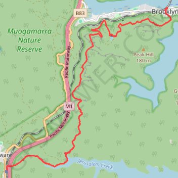
Name: Ku-ring-gai Chase National Park GPS track, route, trail
Start: Jerusalem Bay Track, Cowan, Sydney, The Council of the Shire of Hornsby, New South Wales, 2081, Australia (-33.59327 151.17181)
End: 10, Dangar Road, Brooklyn, Sydney, The Council of the Shire of Hornsby, New South Wales, 2083, Australia (-33.54718 151.22670)
Coordinates: -33.59329 151.17181 -33.54702 151.22810
Click on a GPS track to view route, its statistics and profile.
Australia > New South Wales > Sydney
Bike loop from St Ives. Ku-ring-gai Chase National Park. Brisbane Water National Park. Garigal National Park. #Bike #Loop
Distance: 134.1 Km • Elevation gain: 2,140 m • Maximum elevation: 228 m