עין ושרף פוביצר
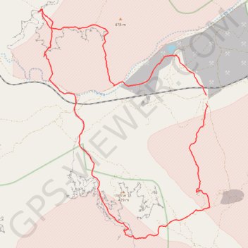
- Distance: 36.5 Km
- Elevation gain: 936 m
- Maximum elevation: 471 m
- Elevation loss: 929 m
- Minimum elevation: 116 m
Interactive map
GPS track profile
About this GPS track
Name: עין ושרף פוביצר GPS track, route, trail
Start: Israel (30.80100 35.03313)
End: חניון השיטים, Arava Tichona Regional Council, Beersheba Subdistrict, Israel (30.79773 35.03295)
Coordinates: 30.74510 34.95703 30.83449 35.03463
Topography: Israel topographic map, elevation, terrain